
Mobileye Patents a Way to Measure Distance Using Road Slope Data
Cameras on self-driving systems struggle to judge how far away objects are when the road dips or crests a hill. Mobileye's new patent tackles that blind spot by combining the camera's view with the road's elevation profile from a map.
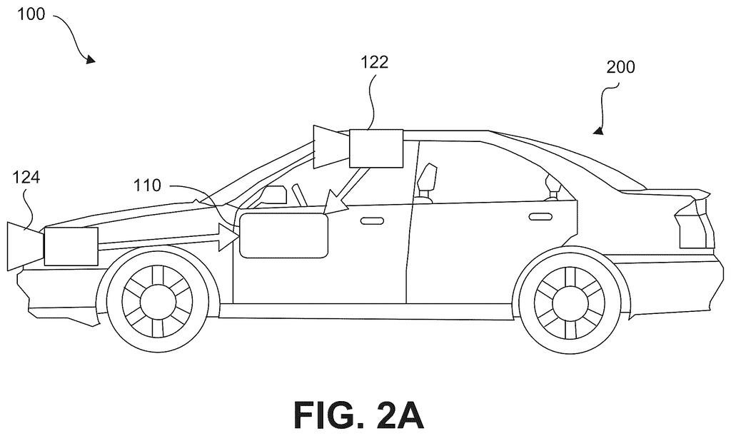
How Mobileye's camera system judges distance on hilly roads
Imagine you're driving over a hill and your car's camera spots a stopped vehicle on the other side of the crest. The road curves away from you, so the stopped car appears to sit at a strange height in the image, and the camera, on its own, can't tell whether that vehicle is 50 feet away or 500 feet away.
Mobileye's patent describes a system that cross-references what the camera sees with map data showing how the road rises and falls ahead. By knowing the elevation profile of the road, the system can work out a much more accurate estimate of how far away that object actually is.
That distance figure then feeds into the car's navigation decisions: whether to slow down, change lanes, or hold course. The goal is to make driver-assist and self-driving technology more reliable in the real-world conditions where roads aren't flat.
… determine, based on the vertical displacement of the object and the elevation profile for the road extending away from the location of the host vehicle, a distance from the host vehicle to the object …
Translation: The system figures out how far away an object is by combining how high or low it looks with map data showing the slope of the road.
How elevation profiles fill in what the camera alone can't see
The system starts with a camera image of the area around the vehicle. A processor analyzes the image to spot objects in the scene, such as other vehicles, pedestrians, or obstacles, and measures the vertical displacement of each object (how high or low it appears in the frame relative to the car's own camera position).
On flat ground, that vertical position in the image is a decent proxy for distance. But on hilly roads, the geometry breaks down: an object on a downward slope appears lower than it would on a flat surface, and an object cresting a rise appears higher. The camera alone can't separate "far away" from "on a different slope."
To fix that, the system pulls in elevation profile data from a map, which describes how the road rises and falls ahead of the vehicle. By combining the measured vertical displacement with the known road shape, the processor can solve for the actual distance to the object using geometry that accounts for the terrain.
That calculated distance is then used to choose a navigational action, such as braking, steering adjustment, or maintaining speed. The approach means the car isn't guessing on hills; it's doing the math with real topographic context.
What this means for driver-assist systems on uneven terrain
Driver-assist systems already handle flat highways reasonably well. The harder problem is the rest of the road network: winding mountain passes, country roads with crests and dips, freeway on-ramps. If a camera-based system misjudges distance by even a few car lengths on a downhill slope, the difference between a timely brake and a collision can be razor-thin. This patent targets exactly those edge cases.
For you as a driver, the practical payoff is a car that reacts correctly when the road isn't cooperating with the camera's assumptions. Whether that translates into a product feature depends on how Mobileye integrates this into its chips and software, which power driver-assist systems in vehicles from many major automakers.
Intel files its second application we've tracked in our self-driving sensing watchlist since September, building on Mobileye's safe inner lane path.
Cameras on self-driving systems struggle on hilly roads because a camera can see where something appears on screen but not how far away it actually is, and hills scramble even that rough estimate. A car cresting a rise might read a vehicle ahead as closer or farther than it really is, which is exactly when braking decisions matter most.
This patent pairs the camera's view with road elevation data already stored in the map, so the system can cross-check what it sees against the known shape of the road ahead. The driver never touches this, never configures it, never knows it's there.
The concrete payoff is a car that brakes at the right moment on a hilly road rather than too late, a failure most people would only ever notice once.
There are more where this came from
We read every patent application Big Tech publishes and send you the ones worth knowing. Plain English, free, every week.
The drawings
70 drawing sheets from US 2026/0289807 A1 · click any drawing to enlarge


Want this weekly breakdown for a company we don't cover? Patentlyze Pro →
Be the first to weigh in