
Google Patent Introduces Subscription Layers to Organize Vehicle Map Service Data
Google is patenting a way to pipe map data to cars in selective layers, so each vehicle only receives the specific slices of information it is authorized and equipped to use.
What Google's vehicle map subscription layers actually do
Imagine a news app that lets you subscribe to only the sections you care about: sports, weather, local. Google's idea here works the same way, but for the flood of map data that modern vehicles need to drive safely or navigate autonomously.
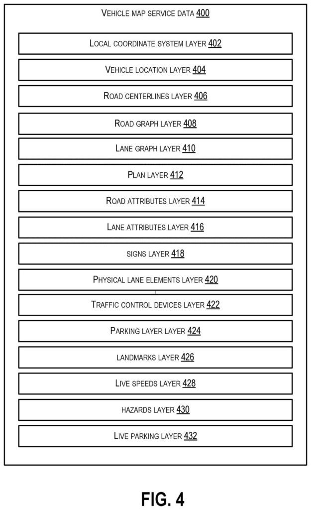
Instead of broadcasting everything to every car, Google's system carves map data into distinct layers, each covering a different type of information. A vehicle's software subscribes to the layers it actually needs, and the system checks those subscriptions before granting access.
The data can also include real-time sensor observations from vehicles themselves, not just static road information. The layered approach means a basic navigation app and a fully self-driving system can share the same underlying service without getting in each other's way or seeing data they shouldn't.
How the protocol assigns and gates each data layer
The patent describes a vehicle map service protocol, essentially a structured rulebook for how map data is organized and distributed. The data is divided into discrete layers, where each layer corresponds to a particular category of information such as road geometry, traffic signals, live sensor readings, or hazard alerts.
Client systems (individual vehicles or the software running on them) register subscriptions to specific layers. When a client requests data, the server checks which layers that client is authorized to receive and delivers only those portions. Access control is bidirectional: a client can be authorized to receive data from a layer, to send sensor observations back into a layer, or both.
The system also incorporates sensor observations from vehicles (real-world measurements the car's cameras or lidar pick up), folding live field data back into the map service alongside the pre-existing geographic information.
Key components include:
- A layer-based data model tied to a defined protocol
- Per-client subscription records that gate access
- Authorization logic covering both inbound and outbound data flow
- Support for heterogeneous clients (basic navigation systems alongside autonomous driving stacks)
What this means for connected and autonomous vehicles
As more vehicles become connected, the volume of map data in motion grows fast. A system that broadcasts everything to everyone wastes bandwidth, creates security exposure, and makes it harder to keep proprietary data away from systems that shouldn't have it. Google's layered approach gives a clean way to serve a wide range of vehicle types and software platforms from one central service without every client getting the full firehose.
For autonomous vehicle programs, which rely on rich, frequently updated map data, having a standardized subscription protocol also matters for interoperability. It suggests Google is thinking about this as an infrastructure service that multiple clients, not just its own vehicles, could plug into.
This is infrastructure plumbing: not flashy, but exactly the kind of protocol-level patent that matters if Google wants to run a serious vehicle data service at scale. The claims were canceled in this publication, which limits its current legal standing, but the underlying architecture reflects real engineering thinking about how to manage map data across heterogeneous vehicle fleets.
There are more where this came from
We read every patent application Big Tech publishes and send you the ones worth knowing. Plain English, free, every week.
The drawings
12 drawing sheets from US 2026/0222775 A1 · click any drawing to enlarge


Want this weekly breakdown for a company we don't cover? Patentlyze Pro →
Be the first to weigh in