Google Patents a System That Builds Floor Plans From Where People Walk
Google wants to reverse-engineer the layout of any building just by watching where people tend to stand and linger — no architectural blueprints required.
How Google maps rooms by tracking foot traffic
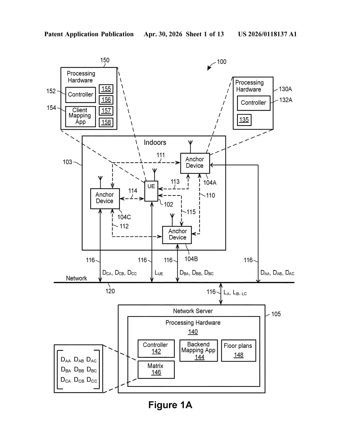
Imagine trying to map the inside of a shopping mall, airport, or hospital without ever getting access to the official blueprints. Google's patent describes a way to do exactly that — by watching where people actually go inside a building over time.
The idea is straightforward: if you track enough people moving through a space, their paths naturally cluster in certain areas — a lobby, a hallway, a break room. Google's system collects those indoor location histories and uses them to infer where the walls and rooms probably are, then stitches together a floor plan automatically.
You'd never see this happening — it works in the background using location data the system already has access to. The result is a machine-generated map of the building's interior, usable for indoor navigation inside apps like Google Maps.
How Google clusters location data into rooms
The patent describes a server-side pipeline with three main steps:
- Location history collection: The system gathers indoor location histories — timestamped position data for one or more users moving through a building over time. These positions are determined using whatever indoor positioning signals are available (Wi-Fi triangulation, Bluetooth beacons, etc.).
- Clustering: The server groups all those position data points into clusters — essentially buckets of locations that are physically close together. The patent mentions proximity to a centroid (the geometric center of a group of points) as the clustering criterion. Think of it like a heat map: areas where people spend more time form denser clusters.
- Room reconstruction: The system divides the building's area into rooms by treating each cluster as a distinct space. The resulting floor plan is stored and made available for indoor mapping applications.
The claim is notably broad — it covers any number of users (even just one), any clustering method, and any building type. The system doesn't require access to existing architectural drawings; it infers the layout purely from behavioral data.
What this means for Google Maps indoor navigation
Google Maps already supports indoor maps for airports, malls, and transit stations — but building those maps today requires manually uploaded floor plans from venue operators. This patent points toward a future where Google could generate those maps automatically, without needing cooperation from building owners. That would dramatically expand indoor mapping coverage.
The flip side is obvious: this system works by tracking where real people walk inside real buildings. Even if the data is anonymized or aggregated, the privacy implications of continuous indoor location tracking are significant. How long is the data retained? Who counts as a "user"? Those questions aren't answered in the patent — and they're the ones that will matter most if this ever ships.
This is a genuinely clever idea for scaling indoor maps without a manual data-entry bottleneck, and it fits neatly into Google's long-term Maps ambitions. But the patent's privacy surface area is enormous — it essentially describes a system for inferring building layouts from surveillance of human movement — and that tension deserves more scrutiny than a filing abstract can provide.
Get one Big Tech patent every Sunday
Plain English, intelligent commentary, no hype. Free.
Editorial commentary on a publicly published patent application. Not legal advice.