
Google Patents an AI System That Lets You Redesign Your Own Maps
Google has filed a patent for a system that uses a generative AI model to let users customize what their digital maps look like, down to individual objects on the map, and then save those changes as a personal layer on top of the standard map.
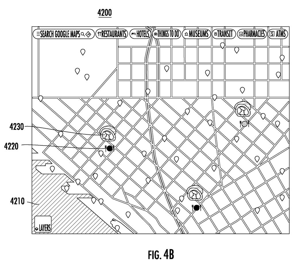
What Google's AI map customization actually does
A city planner stares at Google Maps trying to figure out which route is best for a new bike lane, but the default map shows too much clutter and not enough detail for the job at hand. You can picture the same frustration when you need a map that just works differently than the one you're given.
Google's patent describes a system that would let you feed instructions into an AI model to change how specific things on a map look, things like roads, buildings, or landmarks, and have the AI generate a modified version based on your input. You're not editing pixels by hand; you're describing what you want and the AI handles the visual output.
The result gets saved as a custom map layer, a separate sheet of visual information that sits on top of the standard map. That means your changes don't break the original; they're stored independently and can be toggled or modified later.
… processing, via a generative machine-learned model, an input customizing one or more features associated with at least one of the plurality of graphical objects to generate the customized digital map …
Translation: An AI uses your custom text or inputs to change how map objects look.
How the generative model edits and saves map layers
The patent describes a computing system built around a generative machine-learned model (an AI similar in spirit to the kind that produces images from text prompts) that takes user input describing changes to map objects and produces a visually updated map based on those instructions.
The core process has three steps:
- The system shows you a standard digital map made up of multiple map layers (think of layers like transparencies stacked on top of each other, each holding different information such as roads, terrain, or labels).
- You provide an input, whether text, a selection, or another format the patent leaves open, that specifies how one or more graphical objects on the map should be changed. A graphical object could be a road, a building outline, a park boundary, or any visual element on the map.
- The generative model processes that input and produces a new version of the relevant objects with the customized appearance, which is then packaged into a new customized map layer stored alongside the existing layers.
The patent does not specify exactly what kinds of customization are allowed, leaving the input format and the model architecture deliberately broad. What it does make clear is that the customized layer is treated as a first-class layer in the system, meaning it can persist, be recalled, and presumably be shared or applied to other map views.
… generating a customized map layer based on the customized digital map and including the customized map layer among the plurality of map layers.
Translation: The system saves your custom changes as a brand new layer you can toggle on future views.
What this means for everyday Google Maps users
For everyday users, this could mean being able to tweak Google Maps to highlight what matters to you, say, emphasizing bike paths, dimming highways, or calling out specific building types, without needing any design skills. The AI handles the visual work; you just describe what you need.
For professional use cases, urban planners, logistics coordinators, or accessibility researchers could build custom map views tailored to their analysis without exporting data to separate tools. Google's interest in AI-assisted mapping tools suggests this fits a broader pattern of adding generative AI to products people already use daily, rather than launching entirely new applications. Whether the feature ever ships, and in what form, depends on how well the AI model performs on real-world map complexity.
Google's 38th filing in the AI vision work we've tracked since May adds to earlier applications on self-built image structures and one model for both tasks.
On the path to shipping, this patent has a real advantage: it describes software changes, not new hardware. Google already runs the underlying pieces, a map renderer, a layer system, and access to large AI models capable of following visual instructions. Nothing here requires building something from scratch.
The hard part is accuracy. A map that looks beautiful but shrinks roads or buries landmarks is worse than useless for navigation. The patent is silent on how the system would prevent AI customization from distorting real geographic information, and that gap is where most of the actual engineering work lives.
The shortest route to a real product is probably a narrow one: let users adjust colors, icons, or label styles without touching the underlying geographic data. That is a cosmetic change, not a navigation overhaul, and it is small enough to test before any wider release.
There are more where this came from
We read every patent application Big Tech publishes and send you the ones worth knowing. Plain English, free, every week.
The drawings
12 drawing sheets from US 2026/0276401 A1 · click any drawing to enlarge


Want this weekly breakdown for a company we don't cover? Patentlyze Pro →
Be the first to weigh in