
Nvidia Files Patent to Help Cars Find Their Place on a Basic Flat Map
A car that can work out exactly where it is using one camera and a bare-bones street map: that is the pitch in this Nvidia filing.
What Nvidia's flat-map patent asks a car to do
Imagine your car pulling into a city where the only map it has is a basic street plan. It shows where signs, poles and fences stand, but says nothing about how tall they are. Could it still work out exactly where it is?
That is the question behind this Nvidia filing. Detailed 3D maps are expensive to build and keep current, and the filing notes that in some places, China for example, rules limit what 3D data can be collected and used. So Nvidia describes a way to get by with the flat version.
Here is the trick. The camera spots something like a speed limit sign, and the system works out the stretch of road where that sign could be standing. It then lays the flat map over the photo and checks whether the map's version of the sign lines up. If it doesn't, the car adjusts its guess about its own position until the two agree.
… localizing the machine to a two-dimensional (2D) map of an environment, the localizing being based at least on an analysis between the 2D map and one or more estimated locations in 2D image space corresponding to one or more images of the environment …
Translation: The vehicle figures out its position by comparing flat map data with flat camera images of the surroundings.
How a camera photo gets lined up with the map
The claims cover a machine (a car, a robot or something similar) built around a chip that combines CPUs, GPUs and hardware accelerators (specialized circuits for fast image and AI work), plus sensors that look outward. The machine decides how to act based on localizing itself, meaning finding its position, on a 2D map.
That map can be a standard-definition map, which records where objects sit on the ground but leaves out height. The system analyzes a camera image for objects such as signs or poles. For each one, it estimates the points in the image where part of the object could meet the ground. Those points are compared with where the map says the object should appear once the map is projected onto the image.
The filing walks through the steps like this:
- A neural network (a trained AI model) finds objects and picks points on them, such as the two sides of a sign.
- The system draws a line from each point down toward the ground, aimed at a vanishing point (the spot where parallel lines seem to meet in a photo). That point comes from the camera's tilt relative to gravity.
- It scores the mismatch between map and image as a "cost," using distance measurements.
- It nudges the position guess and repeats until the cost is low enough.
One camera is enough, according to the description. The approach also avoids a weakness of older methods that triangulate (measure from several views over time), where small errors pile up.
Traditional systems rely on expensive, detailed high-definition maps that require constant updates. This disclosure describes a more practical approach using simple two-dimensional maps that show where objects are located but that do not include height or elevation data.
Translation: Self-driving cars usually need costly 3D maps, but this method uses basic flat maps without elevation details.
Why cheaper maps matter for Nvidia's self-driving
Self-driving and driver-assist systems need to know where they are, and the usual answer is a detailed 3D map that someone has to build and update constantly. If a car can get a good position fix from a simple flat map and one camera, that could mean lower costs, less data to store and process, and a way to work where detailed 3D mapping is restricted.
For you, that could eventually mean driver-assist features that work in more places, and on cheaper cars. For Nvidia, which sells the chips and software that run this kind of math, a lighter-weight method fits well with the hardware described in the claims. This is a patent application, so it shows a direction rather than a finished product.
Nvidia's 99th filing we've tracked since May in the self-driving sensing race adds to a run that includes one on radar speed detection and one on camera pixel cleanup.
Dropping height information is the real cost here. Without it, the system has to find its position by matching what the camera sees, signs, poles, fences, against a flat picture of the world. Block those landmarks with a parked truck or build the road up a steep hill, and the match gets shaky fast.
The flat-ground assumption is the second crack. Real streets tilt, dip, and curve, and the document does not explain how the system handles those cases without losing its footing.
Even so, the trade looks worth making for a driver-assist system that needs to work across thousands of ordinary roads rather than a handful of perfectly mapped ones. A single camera and a simple map cost a fraction of constant city-wide 3D scanning, and the savings matter when the goal is broad coverage rather than perfection on a closed course.
Get our take in your Top Stories
Liked this breakdown? Add Patentlyze as a preferred source on Google, and our plain-English take shows up more often in your Top Stories the next time Nvidia patent news breaks.
There are more where this came from
We read every patent application Big Tech publishes and send you the ones worth knowing. Plain English, free, every week.
The drawings
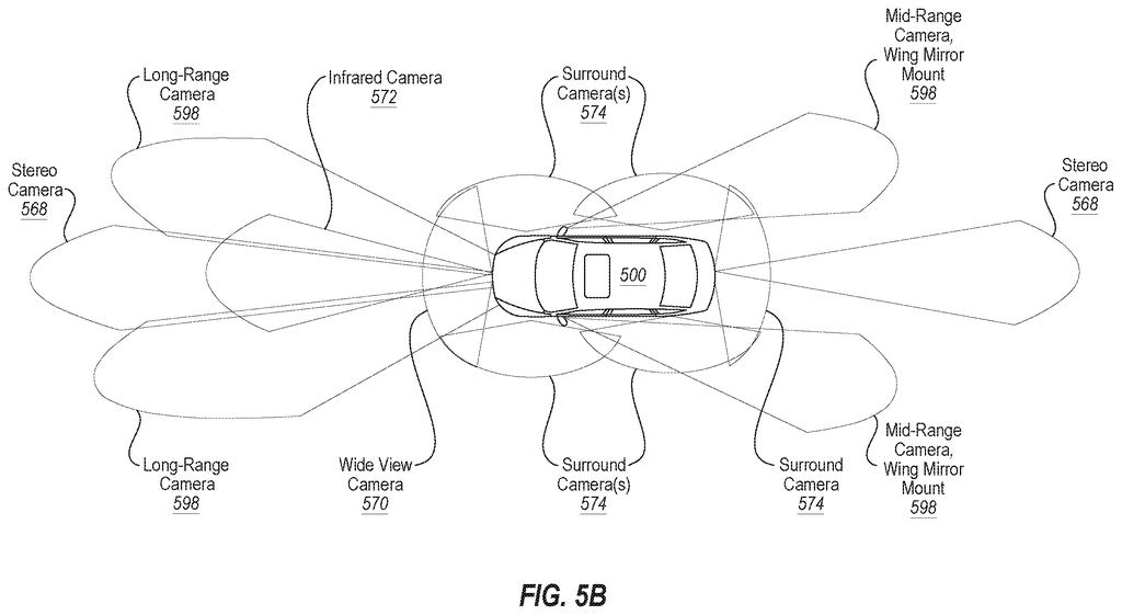
10 drawing sheets from US 2026/0328587 A1 · click any drawing to enlarge


Show the other 2 sheets


Want this weekly breakdown for a company we don't cover? Patentlyze Pro →
Be the first to weigh in