
Wing Aviation Patents a Remote Camera System That Pauses Drone Flights When Something Looks Wrong
Before a delivery drone takes off or lands, a remote human operator checks a live camera feed to confirm the area is safe. If anything looks off, the whole operation stops until it's resolved.
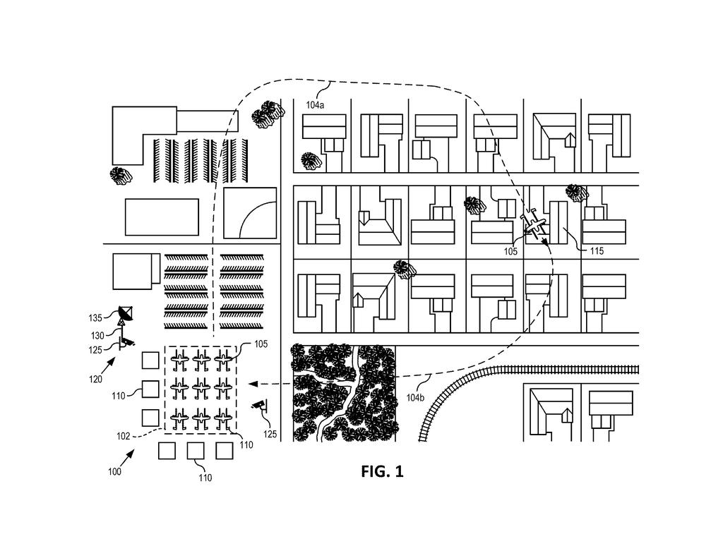
What Wing's drone-zone safety cameras actually do
Imagine a delivery drone is about to drop a package in a suburban backyard, but a dog has wandered into the landing zone or someone has broken through the perimeter. There's no one physically on-site to notice. That's the problem Wing Aviation's new patent is designed to solve.
The system uses cameras installed at drone operation areas to capture live images of two things: the boundary around the zone (think fencing or marked lines) and the clear path a drone needs to fly. Those images get sent to remote operators who check them against what the area is supposed to look like. If anything is out of place, a real human can hit pause on all drone activity until the issue is fixed.
This keeps a person in the loop for safety decisions without requiring someone to stand guard on-site at every drone hub. For autonomous delivery, that's a meaningful safeguard.
capture image data with a camera related to a verification target including a boundary of the autonomous flight operational area or a flight line of an unmanned aerial vehicle of the autonomous flight operational area, the verification target having a nominal condition …
Translation: A camera takes pictures of the drone flight path or property boundary to check that everything looks normal.
How the system detects and escalates a boundary breach
The patent describes a visual monitoring system built for autonomous flight operational areas, meaning the physical locations where unmanned aerial vehicles (drones) take off, land, and operate.
Cameras at the site capture image data tied to specific verification targets, which are defined in the patent as two things:
- The boundary of the operational area (a fence, a marked perimeter, or any barrier that should stay intact and unbroken)
- The flight line of a drone (the path it needs to travel, which must be free of obstacles)
Each verification target has a nominal condition (what it should look like when everything is normal). The live camera images are transmitted to a remote location, where human operators compare them to that baseline. If the operators spot an off-nominal condition (meaning something doesn't match, like a gap in the fence or an object blocking the flight path), the system automatically pauses all operations at that site until the problem is cleared.
The logic runs on a non-transitory computer-readable medium (essentially software stored on a chip or drive) connected to the site's cameras and to the remote display used by operators. The human review step is built directly into the operational workflow, not treated as an optional check.
If an off-nominal condition of the first verification target is detected by the operational personnel, the visual monitoring system can pause operations at the autonomous flight operational area until the off-nominal condition of the first verification target is resolved.
Translation: If workers spot a problem in the images, the system stops all drone flights until the issue gets fixed.
What this means for drone delivery in your neighborhood
For people who live near a drone delivery hub or expect packages dropped by autonomous aircraft, this patent addresses one of the most reasonable concerns: who is watching when something goes wrong on the ground? The answer here is a remote human, not just an algorithm.
The practical payoff is that a stray person, a broken fence, or a parked car in the wrong spot could stop a flight before an incident happens, not after. Google's long bet on autonomous drone delivery means Wing needs frameworks like this to satisfy regulators and build public trust. Whether the system performs as described in real conditions is another question, but the architecture puts a human check at the exact moment it matters most.
Google's 20th filing in our camera patent coverage since May follows earlier applications like sharpening blurry photos by distance and routing sound around camera hardware in the work we've tracked.
The core idea here is straightforward: cameras watch the area, humans review the footage, and flights stop if something looks wrong. That is a sensible safety architecture for a technology that still makes a lot of people nervous.
What stands out is the deliberate choice to keep a human in the loop rather than automate the safety check entirely. Wing could have patented an AI system that detects anomalies on its own, but this filing puts the judgment call on a remote operator. That's either a sign of regulatory caution or genuine humility about the limits of computer vision in unpredictable outdoor environments. Probably both.
For anyone living near a drone delivery zone, the concrete payoff is that an extra pair of eyes, somewhere, is checking conditions before a drone flies over your yard. That won't satisfy everyone, but it's a more reassuring answer than 'the algorithm decided it was fine.'
There are more where this came from
We read every patent application Big Tech publishes and send you the ones worth knowing. Plain English, free, every week.
The drawings
3 drawing sheets from US 2026/0301591 A1 · click any drawing to enlarge


Want this weekly breakdown for a company we don't cover? Patentlyze Pro →
Be the first to weigh in