
Qualcomm Patents a Way to Measure Building Heights from Aerial Shadows
Your city's skyline might get a lot more accurate on digital maps. Qualcomm has filed a patent for figuring out how tall buildings are, not by surveying them on the ground, but by measuring the shadows they cast in aerial photos.
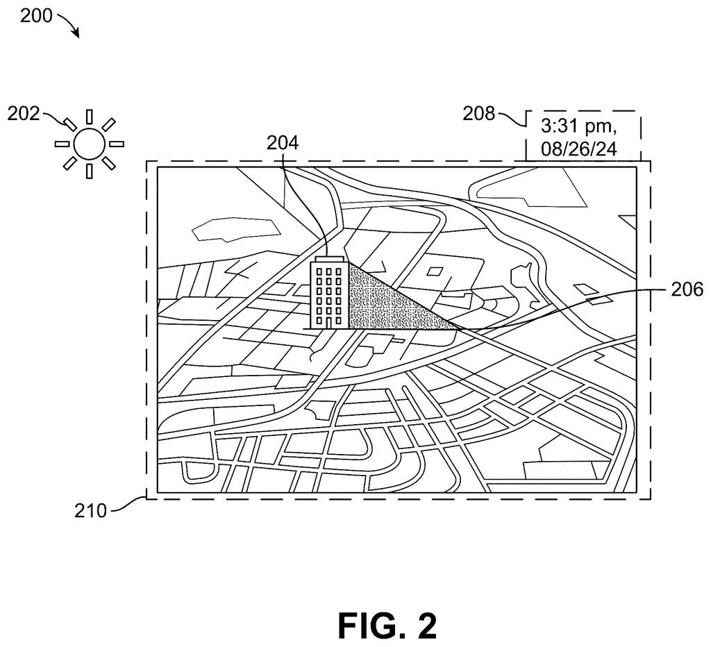
How Qualcomm reads building heights from aerial photos
A satellite image stares down at a city block, full of buildings of every height. You probably notice them as shapes, but a Qualcomm system described in this patent looks at their shadows.
The idea is straightforward: longer shadows mean taller buildings, and if you know the sun's position when the photo was taken, you can do the math. The system analyzes aerial images of a group of buildings, figures out their heights from their shadow lengths, and then uses those confirmed heights to estimate the heights of a second group of buildings that might be harder to measure directly.
This is the kind of work that goes into building accurate 3D city models, sometimes called digital twins, which are detailed virtual replicas of real-world environments used in mapping, navigation, and urban planning.
determine heights of a first set of one or more buildings associated with a first area of an environment based on a length of shadows of the first set of one or more buildings represented in one or more aerial images …
Translation: The system calculates how tall buildings are by looking at how long their shadows are in photos taken from above.
How shadow length translates into a building's height
The patent describes a two-stage process. In the first stage, a computing device processes one or more aerial images and measures the length of shadows cast by a known set of buildings. Using the sun's angle at the time the photo was taken, it converts shadow length into an estimated building height. This is geometry, the same principle a surveyor uses with a protractor, applied automatically to image data.
In the second stage, the system takes the heights it has just confirmed and uses them as a reference to determine the heights of a second set of buildings. The patent does not specify exactly how this inference works, whether it is a learned model, a geometric relationship between neighboring structures, or something else, but the key claim is that the first set's measured heights inform the second set's estimates.
- Input: aerial images showing building shadows
- First output: confirmed heights for a reference group of buildings
- Second output: estimated heights for an adjacent or related group, derived from the first
The system is framed around building a digital twin, a virtual 3D model of a real environment, which needs accurate vertical data to be useful for navigation, simulation, or city planning.
The computing device can determine, based on the heights of the first set of one or more buildings, heights of a second set of one or more buildings.
Translation: Once it knows the height of some buildings, it uses that information to figure out how tall nearby buildings are.
What this means for digital maps and city modeling
Accurate building heights are surprisingly hard to collect at scale. Ground surveys are slow and expensive, and existing map databases often leave height fields blank or filled with rough guesses. A system that can pull height data straight from aerial imagery, without specialized 3D sensors like lidar, could speed up how quickly digital maps get populated with real vertical data.
For you as a user, this shows up in turn-by-turn navigation that actually accounts for buildings blocking GPS signals, in augmented-reality apps that overlay information on real streets, and in any service that depends on a city looking right in 3D. Qualcomm's track record in mapping and positioning patents gives this filing a plausible home in the chip and software stack that powers those kinds of location services.
Qualcomm's 414th filing in our Qualcomm coverage since May extends its car-safety work, building on camera self-positioning and priority sensor filtering.
Shadow length plus sun angle equals building height: it is geometry that has existed for centuries, and this patent applies it to the problem of building accurate digital maps of cities at scale.
The good news for anyone hoping to see this in a real product is that it does not require new hardware. It runs on aerial photos that already exist, which means the main work is writing software, not manufacturing anything.
The harder question is whether the accuracy holds up where it matters most. Crowded city centers, cloudy days, and locations far from the equator all make shadow-based measurement unreliable, and the patent's second step, using confirmed heights to guess at nearby ones, is where the whole system either earns its keep or falls short.
There are more where this came from
We read every patent application Big Tech publishes and send you the ones worth knowing. Plain English, free, every week.
The drawings
11 drawing sheets from US 2026/0278821 A1 · click any drawing to enlarge


Want this weekly breakdown for a company we don't cover? Patentlyze Pro →