
Google Patents a Faster Tool for Building Lifelike Scenes Without Blurry Edges
When AI systems reconstruct a 3D scene from photos, the results can be riddled with jagged edges and missing details. Google has filed a patent for a faster, cleaner approach that attacks both problems at once.
What Google's NeRF aliasing fix actually does for 3D images
Ever tried to zoom in on a photo only to find it turns into a blocky mess? AI-generated 3D scenes have the same problem, and fixing it usually means a much slower rendering process.
Google's patent describes a system for building 3D scenes from ordinary 2D photos, a technology called Neural Radiance Fields (or NeRF). The tricky part: existing fast versions of NeRF use a grid structure that doesn't understand distance or scale, so close-up or far-away views end up with jagged edges and missing chunks of the scene.
The new approach samples the scene in a cone shape (the way a camera lens actually sees the world) and uses a mathematical smoothing technique to fill the grid more accurately. The result, according to Google, is fewer errors and faster training time than previous methods, which is a combination that's proven difficult to pull off.
… sampling a plurality of samples along a sampling direction of the multidimensional representation according to a multisampling pattern, the multisampling pattern representing a conical frustum …
Translation: The system shoots cone shaped rays into a digital 3d scene to gather color and depth data from multiple points at once.
How the cone-sampling and Gaussian method removes jagged edges
NeRF models work by learning, from a set of 2D photos, how a 3D scene looks from any angle. Faster NeRF variants speed things up by storing scene information in a feature grid, a 3D lookup table the model can query quickly. The problem is that grids have a fixed resolution, so when you ask for a view at a scale the grid wasn't built for, you get aliasing: jagged edges, flickering textures, or missing detail.
Google's system tackles this by changing how it samples the scene when building the grid. Instead of sampling along a thin ray (like a laser pointer), it samples along a conical frustum (the cone-shaped volume a camera pixel actually captures). This is a more realistic model of how a lens works at different zoom levels and distances.
From those cone samples, the system generates isotropic Gaussians (smooth, bell-curve-shaped blobs that represent uncertainty about exactly where a point is in space). Those blobs are then interpolated (blended) into the feature grid, effectively letting the grid understand scale and smooth over the gaps that cause artifacts.
The output goes into a proposal model, a lightweight neural network that focuses rendering effort on the parts of the scene that actually matter, and the final result is a clean 2D view of the scene from any angle.
… these grid-based approaches lack an explicit understanding of scale and therefore often introduce aliasing, usually in the form of jaggies or missing scene content …
Translation: Traditional fast 3D rendering methods struggle to understand object sizes, which causes jagged lines and visual glitches.
What this means for AI-generated 3D photography and maps
NeRF technology is at the center of how companies like Google build photorealistic 3D maps, street-view reconstructions, and AR experiences from real-world photos. Right now, the fastest NeRF methods trade away image quality, while the highest-quality methods train too slowly for practical use. A system that closes both gaps at once matters across a wide range of products from mapping to content creation.
For you as an end user, the downstream effect could be sharper, more accurate 3D scenes in products like Google Maps or Google Photos, especially in tricky situations like aerial imagery at different zoom levels, where aliasing problems are most visible.
Google's 18th filing in the AI simulation space we've tracked since May adds to a run that includes one mapping 3D scenes from photos and one where AI rehearses future moves.
When a 3D scene reconstruction system loses track of distance, it produces visible errors: blurry patches, missing objects, or staircase edges on surfaces that should be smooth. Those errors are not merely cosmetic. A system guiding a robot, measuring a room for renovation, or placing virtual objects in a real space cannot afford mistakes that grow worse the farther away something sits.
The problem scales with ambition. As these reconstruction tools move from research demos into navigation, design, and spatial computing, the tolerance for distance-dependent errors drops toward zero.
This filing addresses that failure directly, carrying a proven approach to scale-awareness into a part of the pipeline where speed demands had previously forced engineers to leave it out. The match between problem size and proposed fix is close, and the problem itself is real enough to justify the effort.
There are more where this came from
We read every patent application Big Tech publishes and send you the ones worth knowing. Plain English, free, every week.
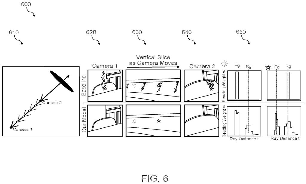
The drawings
11 drawing sheets from US 2026/0278918 A1 · click any drawing to enlarge


Want this weekly breakdown for a company we don't cover? Patentlyze Pro →
Be the first to weigh in