
Apple Patents a Map System That Chooses Which Roads to Show as You Zoom Out
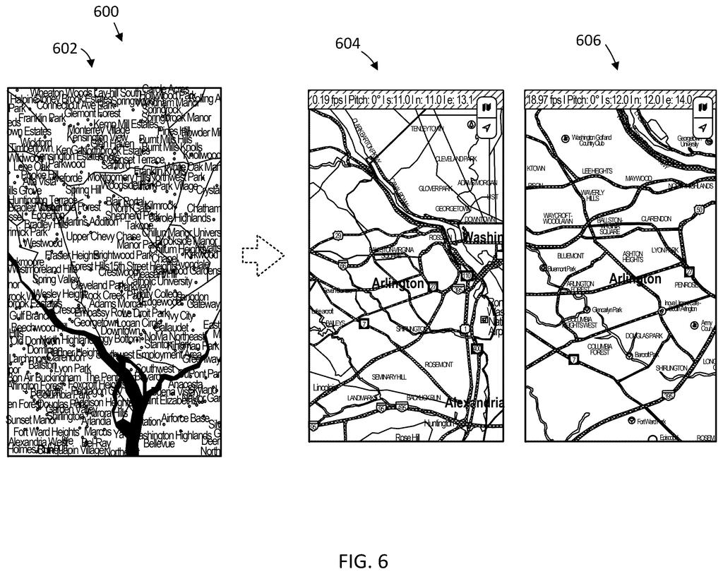
Every time you pinch out on a digital map, you're trusting software to decide what stays visible and what disappears. Apple has filed a patent for a system that specifically figures out which roads to show based on which towns are already on screen.
What Apple's zoom-based road filtering actually does
Every time you zoom out on a map app, roads and labels vanish or appear in a blink. Too many and the screen is a tangle of lines; too few and you lose your sense of where things connect. Apple's patent describes a system designed to handle that tradeoff more deliberately.
Instead of just hiding roads past a certain zoom threshold, the system looks at which towns or settlements are currently visible and then picks the roads that logically connect them. If two towns are on screen, you see the route between them, not a random assortment of nearby streets.
The goal is a map display that stays useful at every scale. Whether you're zoomed in on a neighborhood or pulled all the way out to a regional view, labels and roads are chosen together so the picture still makes geographic sense to you.
… determining, by the system, one or more roads to connect the first settlement and the second settlement based at least in part on the zoom level …
Translation: The software figures out which roads should appear between towns depending on how far out you look.
How the system picks roads based on settlements and zoom
The patent describes a computer-implemented method with four main steps:
- Determine the zoom level of the current map view.
- Select which settlements (towns, cities, or other named places) to label within that view, based partly on that zoom level.
- Identify the roads that connect those selected settlements to each other, using the zoom level as a key input.
- Render the map with those specific roads displayed, linking the labeled places together.
The key idea is that road selection is driven by which settlements are already chosen to appear, not treated as a separate, independent decision. At a high zoom level (very close up), you might show local streets connecting two nearby towns. At a low zoom level (very far out), the system would pick major roads or highways connecting larger cities.
This creates a kind of internal consistency: every road shown on screen has a purpose relative to the labeled places around it, rather than appearing because it crossed an arbitrary visibility cutoff. The patent notes that labels, settlements, and roads are all factored together in the display decision.
… determine which settlements, labels, and/or roads are to be displayed within a display of a map based on a current zoom level of the display of the map …
Translation: The app decides what cities, names, and highways to show based on your current map zoom.
What this means for Apple Maps on small screens
For everyday map users, the clearest benefit is a less cluttered screen at any zoom level. On a phone, screen space is tight, and a map that floods you with road names you can't use in context is actively unhelpful. A system that ties road visibility to town visibility means the map stays readable whether you're planning a cross-country route or navigating a city block.
For Apple specifically, Apple's bet on maps as a core platform feature makes display quality a real differentiator. This patent targets a very specific rendering decision, which means it could ship as a refinement inside the existing Apple Maps engine without requiring new hardware or sensors. The shortest path from this filing to a user-facing update is essentially a software change to the maps rendering pipeline.
Apple's 498th filing we've tracked since May adds to a run of display and camera work, including one on context-aware dimming and one on multi-camera sync.
Apple's patent describes a simple rule: as you zoom out on a map, show fewer roads, but keep the ones that connect towns you can still see. Everything this needs already exists in any map app today: a list of places, a zoom level, and a set of roads. No new hardware, no new data source, nothing that has to be invented before this can ship.
The shortest path from this document to a real product update is almost entirely just writing the filtering logic and testing it across thousands of zoom-and-scroll combinations. That is real engineering work, but it is not a research problem. A maps team could plausibly fold this into a routine release.
Users will never read a patent to understand why a map feels less cluttered at 30,000 feet. But that invisible improvement, roads appearing and disappearing at exactly the right moment, is precisely what this patent is designed to protect. It matters which is how most lasting product polish works.
There are more where this came from
We read every patent application Big Tech publishes and send you the ones worth knowing. Plain English, free, every week.
The drawings
17 drawing sheets from US 2026/0301607 A1 · click any drawing to enlarge


Want this weekly breakdown for a company we don't cover? Patentlyze Pro →
Be the first to weigh in