
Google Files Patent for Autonomous Cars That Share Sensor Data to Eliminate Blind Spots
Even the best self-driving car is blind to what's around the corner, so Waymo is patenting a way for its vehicles to borrow sensor data from other vehicles or roadside cameras to see what their own hardware physically can't.
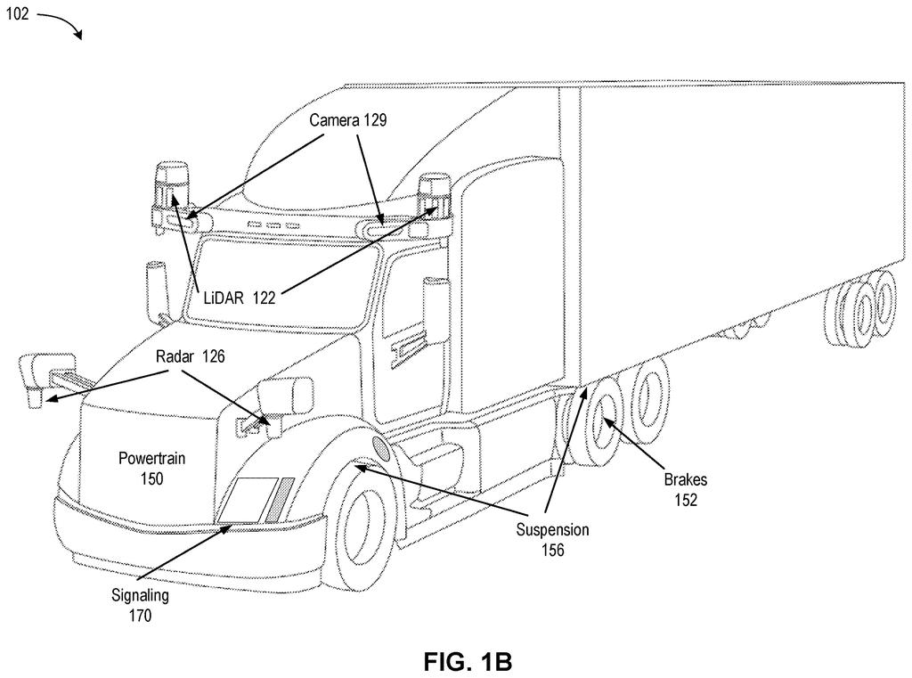
How Waymo's sensor-sharing actually works on the road
A delivery truck blocks the intersection. A curve in a mountain road hides oncoming traffic. A self-driving car's sensors, no matter how good, can only see what's in front of them.
Waymo's new patent describes a system where one of its self-driving cars can reach out, over a wireless connection, to a second source of sensor data, either another vehicle nearby or a fixed hub installed at a tricky location like a loading yard, a fueling station, or a blind curve. That second source sends back real-time information: lidar point clouds, radar readings, camera images, or simply a summary of what objects are nearby, how fast they're moving, and where they're headed.
Your car's computer then combines its own view with the borrowed view and uses both to decide how to drive. The result is a field of vision that extends well beyond what any single set of sensors could cover on its own.
… receiving, by a data processing system of the first AV, over the communication channel, a second run-time data for a second region of the driving environment of the first AV, wherein at least a portion of the second region is not accessible to the first sensing system …
Translation: The car downloads sensor data from an outside source to cover areas its own sensors cannot see.
How the AV merges borrowed data with its own sensor feed
The patent describes a two-part data pipeline. First, a Waymo vehicle (called the "first AV") establishes a communication channel with an external host. That host can be one of two things: a stationary hub placed at a strategic location, or a second autonomous vehicle that happens to have a better angle on the same stretch of road.
The stationary hubs are particularly interesting. The patent specifically names loading yards, fueling stations, checkpoints, curved road sections, and mountain summits as candidate locations, places where blind spots are predictable and dangerous.
Once the channel is open, the first AV collects its own sensor readings ("first run-time data") for the area it can see, while simultaneously pulling down "second run-time data" for the area it cannot. That second dataset can be raw sensor output:
- Lidar (laser-based distance mapping)
- Radar (radio-wave object detection)
- Camera or sonar feeds
Or it can be pre-processed object-level information: position, size, speed, and direction of nearby objects.
The AV's onboard data processing system then combines both streams and uses the merged picture to compute a safe driving path. The patent doesn't specify a particular fusion algorithm, keeping the scope broad.
The external host may be a stationary hub positioned at strategic locations (e.g., loading yards, fueling stations, checkpoints, curved road sections, or mountain summits) or a second autonomous vehicle.
Translation: Roadside infrastructure or other cars can act as data relays to help vehicles see around blind spots.
What sensor-sharing means for self-driving safety at blind curves
Blind spots are one of the hardest unsolved problems in autonomous driving. Fixed sensor arrays on a single vehicle have physical limits, a car literally cannot see around a solid wall or a parked truck. The standard industry workaround is to build the car's software to slow down and treat anything hidden as a potential hazard, which works but is conservative and can make the car feel hesitant in dense urban environments. Waymo's approach here is to simply extend the car's effective eyes outward by tapping into infrastructure or other vehicles that already have a better vantage point.
The patent covers an elegant range of deployment scenarios, from peer-to-peer vehicle sharing to purpose-built roadside hubs at known danger zones. That flexibility matters because it means the system could be deployed incrementally. As Waymo and similar companies push into more complex terrain, mountain roads, industrial yards, international markets with different road layouts, the new tech patents coming out of the autonomous vehicle space increasingly show a shift toward cooperative sensing rather than any single vehicle trying to see everything on its own.
The problem this patent attacks is real and expensive: a self-driving car that hesitates at every blind corner is both slower and, in some edge cases, less safe than one that actually knows what's there. The approach matches the scale of that problem. Deploying fixed sensor hubs at predictable chokepoints (loading yards, mountain roads) is far more tractable than trying to solve blind spots purely in software. The peer-to-peer vehicle sharing component is harder to operate at scale today, but the stationary hub angle is something Waymo could realistically deploy within its existing Waymo One and Waymo Via service geofences without waiting for a dense vehicle fleet.
There are more where this came from
We read every patent application Big Tech publishes and send you the ones worth knowing. Plain English, free, every week.
The drawings
10 drawing sheets from US 2026/0233755 A1 · click any drawing to enlarge


Want this weekly breakdown for a company we don't cover? Patentlyze Pro →
Be the first to weigh in