
Samsung Patents a Device That Maps a Room by Looking Around and Shows Where You Are
Your phone's GPS is useless the moment you walk indoors. Samsung is patenting a system that solves that by having a device build its own overhead map of a room in real time, using nothing but the camera and a few sensors.
What Samsung's live indoor map system actually does
Ever tried to find a specific exhibit in a huge museum, only to realize your phone has no idea where inside the building you are? GPS stops working the moment you're past the entrance doors, and most buildings have no indoor navigation at all.
Samsung's patent describes a device that fixes this by figuring out its surroundings on its own. It points the camera at the room around it, reads the scene to understand what it's looking at, and then mentally "flips" that view to build a top-down floor-plan style map, the way you'd see the space from a drone overhead. The map updates as you move.
Once the map exists, the device works out its own position using its built-in sensors and displays a marker on that map showing exactly where you are. No Wi-Fi fingerprinting, no pre-loaded building blueprints required, just the camera and the device's own processing.
obtain, using the camera, an image related to a space in which the electronic apparatus is present, obtain a semantic feature based on the image, obtain a spatial feature representing a region of the space from a top-down viewpoint based on the semantic feature …
Translation: The device takes a picture of the room and analyzes it to create an overhead map of the space.
How the camera view becomes a top-down floor map
The system chains together several processing steps, each building on the last.
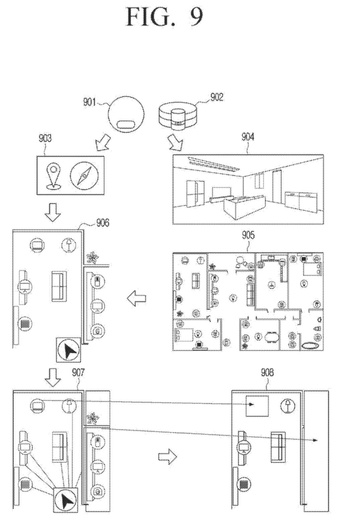
First, the camera captures an image of the room. The device runs a semantic feature analysis on it (meaning it tries to understand the meaning of what it sees: walls, furniture, doorways, floors) rather than just recording pixels.
Next, it uses those semantic cues to derive a spatial feature from a top-down viewpoint. This is the key step: the device takes a ground-level camera image and mathematically reconstructs what that space would look like from directly above, a bird's-eye representation of the room's layout. This lets it build and update an internal map without needing a pre-existing blueprint.
In parallel, the device reads data from its sensor (likely an IMU, the chip that tracks orientation and movement) to calculate pose information, which means its position and direction in 3D space. That pose gets matched to the map, and the display shows a GUI overlay pinpointing where the device is at that moment. The whole loop runs continuously as the device moves through the space.
… obtain pose information of the electronic apparatus based on sensing data obtained by the sensor, and control the display to display a graphic user interface (GUI) corresponding to the pose information on the map.
Translation: It uses motion sensors to figure out where you are and shows your location on the screen.
What this means for indoor navigation on Samsung devices
Indoor positioning is one of the few things smartphones still genuinely can't do well. Airports, hospitals, warehouses, shopping malls and convention centers all present the same problem: you're lost the second you go through the door. A system that builds its own map on the fly, using only a camera, removes the dependency on venue operators to install and maintain dedicated infrastructure.
For Samsung, this fits neatly into its mixed-reality and robotics ambitions. Samsung keeps filing on indoor spatial awareness A robot vacuum, a pair of AR glasses, or a phone held up in a hospital corridor could all use this same core loop. The tricky question is whether the map quality holds up in visually repetitive spaces like long corridors or open-plan offices, where the semantic cues are sparse.
Samsung's 1351st filing in our Samsung coverage since May follows work like a dual-metal light filter and a lens-cover projector.
Using the camera to build a live map of a room means the device does all the heavy lifting itself, with no beacons or special hardware installed in the building. That independence is the whole point, but it moves the cost onto the processor and battery of whatever you're holding.
The camera approach breaks in predictable ways: low light, mirrored walls, and long identical corridors can all fool it. The patent names none of these failure states or how the system recovers from them, which is the honest gap in the filing.
The trade still reads as worth making. Asking every mall or hospital to install proprietary location hardware is a coordination problem that rarely gets solved. A system that works with a camera already in your pocket is the more realistic path, even if the hard edge cases remain unresolved for now.
There are more where this came from
We read every patent application Big Tech publishes and send you the ones worth knowing. Plain English, free, every week.
The drawings
14 drawing sheets from US 2026/0287390 A1 · click any drawing to enlarge


Want this weekly breakdown for a company we don't cover? Patentlyze Pro →
Be the first to weigh in