
Apple Patent Uses GPS Signal Quality to Guide Users Toward Better LEO Satellite Coverage
Satellite connectivity on your phone is only useful if you can actually get a signal. Apple is patenting a way to use the GPS satellites already overhead to tell you whether you're standing in a good spot before you even try connecting to a low-Earth-orbit network.
How Apple's iPhone might coach you to find satellite signal
Imagine you're hiking in a canyon and you need to send an emergency message via satellite. You hold your phone up, but nothing happens. Was it the trees? The cliff wall? Your angle to the sky? Right now, there's no easy way to know.
Apple's patent describes a system that uses the signal from GPS satellites as a quick test of your sky view. If those signals are weak or blocked, the phone warns you to move and points you toward a better spot. It can even track where a low-Earth-orbit (LEO) satellite is heading and show you which direction to face to catch it as it passes.
The system also uses your phone's light sensor (the same one that adjusts screen brightness) to detect whether you're indoors or outside. If you're inside, it nudges you to step out before wasting time trying to connect. It's a coaching tool, essentially, that tries to make satellite connections less of a guessing game.
… provide an indication to move to increase a likelihood of establishing a connection to a low Earth orbit (LEO) satellite based on comparing the signal quality of the global navigation satellite to a threshold.
Translation: Your phone tells you to walk somewhere else when GPS signals are too weak for satellite internet.
How GPS data and light sensors point toward open sky
The patent describes an iPhone-class device that reads two kinds of data to improve your chances of connecting to a LEO satellite (a satellite flying a few hundred miles up, like those in SpaceX's Starlink or Apple's own emergency satellite network).
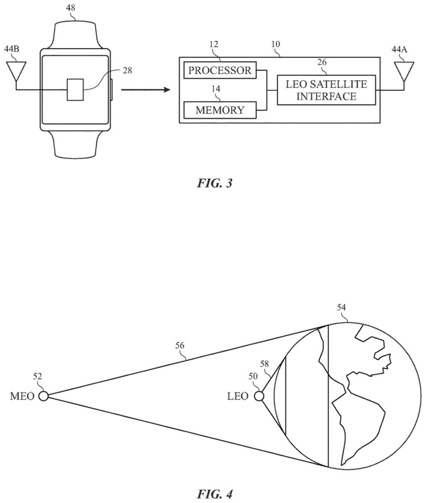
First, it reads GPS signal quality. GPS uses MEO satellites (medium Earth orbit, sitting much higher at roughly 12,000 miles up). Because those satellites are so high and spread widely, their signal strength is a reliable indicator of how open your sky view is. If the GPS signal is strong, the sky is clear. If it's weak, something is blocking you. The phone compares that signal against a threshold and, if it falls short, tells you to move.
Second, it uses satellite position data. LEO satellites zip across the sky in minutes. The patent describes tracking a specific satellite's position and displaying it so you can physically orient your phone or body to face the right direction at the right moment.
Third, it combines time-of-day and light sensor readings. The phone can infer whether you're indoors from ambient light levels, then prompt you to find open sky before attempting a connection. The key components working together are:
- GPS (GNSS) signal quality as a sky-view proxy
- LEO satellite position tracking and on-screen direction cues
- Ambient light sensor data to detect indoor vs. Outdoor conditions
… provide an indication to move the user device to an open sky condition to increase the likelihood of establishing communication with the LEO satellite.
Translation: The device might suggest stepping outside under open skies to get a satellite connection.
What this means for satellite SOS and emergency coverage
Apple added basic satellite SOS to the iPhone 14 and has been expanding those capabilities ever since. The frustrating part for users has always been the setup: you have to stand still, hold the phone at a specific angle, and hope. This patent addresses that friction directly by giving the phone a way to actively coach you rather than leaving you to guess.
For emergency use cases, that difference could matter. If someone is injured in a remote area and trying to reach satellite services, a few seconds of clear guidance on where to move could be the difference between a connection and a failed attempt. The patent also hints at a more general role for GPS infrastructure as a diagnostic layer for next-generation satellite networking, which could influence how other manufacturers approach the same problem.
This is a genuinely practical patent. Satellite connectivity on phones has a well-documented usability problem, and Apple is attacking it with sensors that are already in every iPhone rather than adding new hardware. The GPS-as-sky-view-proxy idea is clever and cheap to implement. Whether it ships as a polished feature or stays buried in the satellite SOS setup flow, it solves a real problem.
There are more where this came from
We read every patent application Big Tech publishes and send you the ones worth knowing. Plain English, free, every week.
The drawings
12 drawing sheets from US 2026/0227523 A1 · click any drawing to enlarge


Want this weekly breakdown for a company we don't cover? Patentlyze Pro →
Be the first to weigh in