
Microsoft Patents a System That Reads Satellite Images to Identify Forests and Crops
Microsoft is patenting a way to automatically tell a forest from a cornfield using satellite data, then trigger the right land-management response without a human having to look at a single photo.
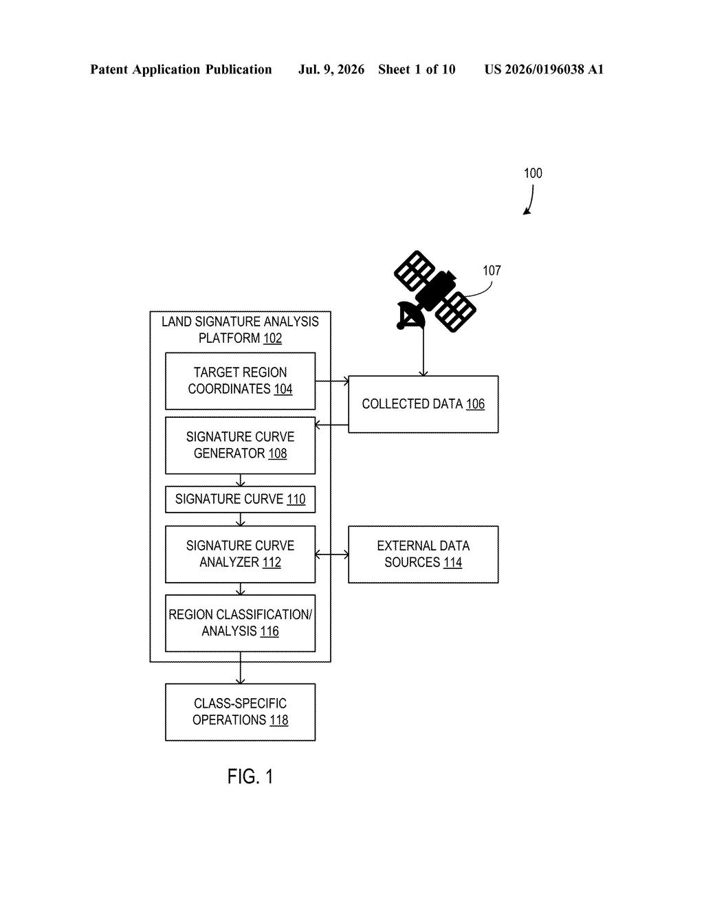
How Microsoft turns satellite photos into vegetation labels
Imagine trying to figure out whether a patch of land in a remote area is a wheat farm, an old-growth forest, or scrubland, without sending anyone there. Right now, that kind of monitoring requires a lot of manual review of satellite images. Microsoft's patent describes a system that does it automatically.
The approach works by pulling satellite imagery for a specific set of coordinates and measuring how green or how reflective the vegetation is across time. Those readings get plotted as a curve, and the shape of that curve acts like a fingerprint for a given vegetation type. A forest looks different from a crop field because forests stay green year-round, while crops go through predictable seasonal cycles.
Once the system figures out what kind of vegetation is there, it can automatically kick off an appropriate action, like flagging a forest for protection or alerting a farm manager that a field looks unhealthy. The whole process runs without anyone having to manually tag a map.
How the signature curve method classifies land cover
The system starts with a set of target coordinates describing a geographic region. It then pulls satellite imagery data for that area and computes a value called the Normalized Difference Vegetation Index (NDVI), a standard measurement that compares how much visible red light versus near-infrared light a surface reflects. Healthy green plants absorb red light and reflect infrared, so a high NDVI means lush vegetation; bare soil or pavement scores low.
Rather than looking at a single snapshot, the system tracks NDVI readings over time and plots them as a signature curve, essentially a graph of greenness across the seasons. Different vegetation types produce distinctly shaped curves: a deciduous forest ramps up in spring, peaks in summer, and drops in fall, while a wheat crop spikes quickly at harvest time and then disappears.
The patent's classification step compares the shape of an observed curve against known reference patterns to label the land cover, for example, identifying it as a forest. Once classified, the system can automatically trigger a vegetation management action, such as initiating a forest preservation workflow or alerting agricultural operators.
- Obtain coordinates and pull satellite imagery
- Compute NDVI data points over time
- Plot the seasonal signature curve
- Match curve shape to a vegetation category
- Trigger the appropriate land-management action
What this means for automated land and forest management
Monitoring forests and farmland at scale is expensive and slow when done manually. A system like this could let governments, conservation groups, or agricultural businesses watch millions of acres continuously without a proportional increase in staff. If a forest starts showing signs of die-off, the system can flag it automatically rather than waiting for someone to notice on a map.
For Microsoft, this fits into its broader push into sustainability and its Azure-based geospatial data services. The patent also aligns with growing demand from corporate agriculture and carbon-credit markets, both of which need reliable, automated ways to verify what's actually growing where. That said, NDVI-based vegetation analysis is well-established science, so the novelty here is more about the automated pipeline than the underlying measurement technique.
This is workmanlike infrastructure, not a scientific leap. NDVI has been used in remote sensing for decades, and signature-curve classification is a known approach. What Microsoft is patenting is a specific automated pipeline that connects satellite data intake, curve plotting, classification, and action triggering into one system. If they fold this into Azure or a sustainability-services product, it could be genuinely useful at enterprise scale, but don't expect this to reinvent how forests are managed.
There are more where this came from
We read every patent application Big Tech publishes and send you the ones worth knowing. Plain English, free, every week.
Want this weekly breakdown for a company we don't cover? Patentlyze Pro →
Be the first to weigh in