
Qualcomm Patents a System That Combines Competing Street and Building Data Into One Accurate Virtual City Model
No single map of the physical world is complete. Qualcomm wants to fix that by teaching a server to stitch together multiple competing 3D models of the same place into one unified picture.
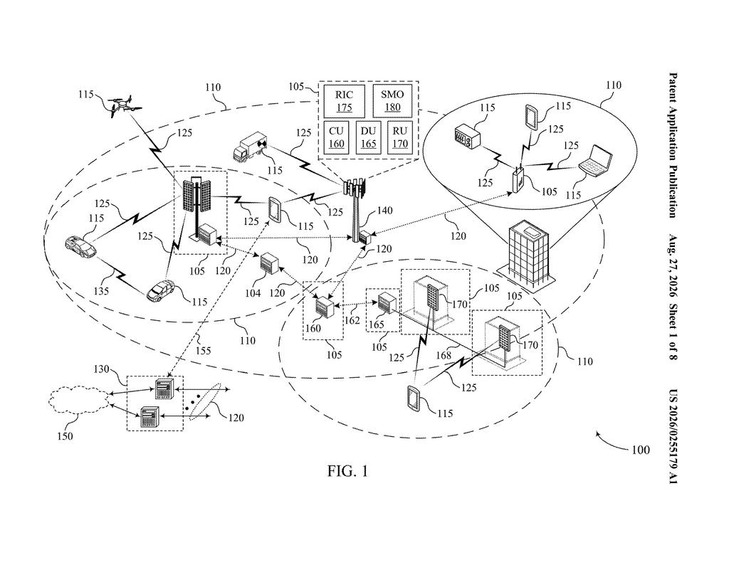
What Qualcomm's multi-source digital twin actually does
Every time a wireless network tries to figure out the best path to send a signal to your phone, it's essentially guessing at walls, buildings, and obstacles it can't see. That guess gets a lot better if the network has a detailed 3D model of the world around you, but the problem is that no single map source has everything right.
Qualcomm's patent describes a system that takes two or more of those 3D models of the same geographic area, each built by a different source, and merges them into a single, more complete picture called a digital twin. Think of it like combining two slightly different tourist maps of the same city to get one map that's more accurate than either alone.
The merged twin can then be used by wireless systems to make better decisions about coverage, signal routing, or where to place network equipment. The merging can happen at any stage of the process, not just at the end, which gives the system flexibility in how it handles the incoming data.
obtain first data associated with a first three-dimensional model of a geographic area and second data associated with a second three-dimensional model of the geographic area; merge information associated with the first data with information associated with the second data; and output a digital twin associated with the geographic area based at least in part on the merging.
Translation: The system takes two different 3D maps of the same place and combines them to create one accurate virtual model.
How the server merges two 3D models into one output
A digital twin is a detailed virtual replica of a physical place, built from mapping data, sensor readings, or 3D scans. Wireless network planners use them to simulate how radio signals travel through buildings and streets before deploying real equipment.
The challenge is that different mapping sources, say one from a satellite imagery company and another from a city government survey, each have gaps, errors, or different levels of detail in different spots. Qualcomm's patent describes a digital twin server that ingests data from at least two of these independent 3D models of the same geographic region and merges them.
The merging is not just a simple overlay. The system works with the underlying data (geometry, materials, spatial metadata) and can combine inputs at any step in the digital twin generation pipeline, not only at the final output stage. That means it can merge raw source data early on, or partially processed models later, giving engineers options depending on what sources are available.
- Obtain a first 3D model of a geographic area from one source
- Obtain a second 3D model of the same area from a different source
- Merge the two datasets into a unified representation
- Output a single digital twin based on the combined data
The resulting twin is intended to be more accurate and complete than either source alone, which is the core value proposition.
A digital twin server may merge data corresponding to the first source (e.g., corresponding to a first three-dimensional (3D) model of a given geographic region) with data corresponding to a second source (e.g., corresponding to a 3D model of the same geographic region, but from a different map source).
Translation: A central computer blends data from different map providers to build a single, unified digital version of a city.
What this means for wireless networks and smart cities
Digital twins are increasingly central to how wireless carriers plan and tune their networks, especially as 5G and future systems try to squeeze more performance out of dense urban environments. A more accurate virtual model of a city means fewer expensive site surveys and better predictions about where signals will travel or fail. For you, the practical downstream effect could be more reliable coverage in complex places like dense downtown grids or indoor venues.
The tension here is real: the patent focuses on combining existing sources rather than generating original mapping data, so its value depends entirely on the quality of the inputs it has to work with. Still, the idea of merging rival data sources into a shared infrastructure model sits squarely in the middle of a broader push toward environment-aware wireless systems, and it's the kind of filing that shows up regularly among new tech patents from chipmakers and network infrastructure companies trying to make AI-driven network planning a practical reality.
Qualcomm's 363rd filing in our Qualcomm coverage since May adds to a location theme seen in the 3D map application and the cell tower indoor positioning work.
The core tradeoff here is trust: when two maps disagree about where a building stands, the system needs a rule for picking a winner, and this patent does not specify one. That gap matters because merging bad data with other bad data does not produce good data, it just produces confidently wrong data faster.
The flexibility to combine maps at any point in the process, rather than only at the end, is a real practical gain. It means the server can accept maps in whatever format different suppliers happen to use, which reflects an honest acknowledgment that the real world does not standardize its data for your convenience.
The cost of that flexibility is complexity: more merge points mean more places where errors can enter the output. Whether that trade is worth it depends entirely on how well the arbitration logic gets built during implementation, and this document leaves that part to someone else.
Get our take in your Top Stories
Liked this breakdown? Add Patentlyze as a preferred source on Google, and our plain-English take shows up more often in your Top Stories the next time Qualcomm patent news breaks.
There are more where this came from
We read every patent application Big Tech publishes and send you the ones worth knowing. Plain English, free, every week.
The drawings
8 drawing sheets from US 2026/0255179 A1 · click any drawing to enlarge


Want this weekly breakdown for a company we don't cover? Patentlyze Pro →
Be the first to weigh in