
Qualcomm Patents a Way to Build 3D Maps That Show How Places Will Change Over Time
Qualcomm has filed a patent for a system that can take a 3D map of a city block and predict what that same block will look like months or years from now, without sending anyone back out to rescan it.
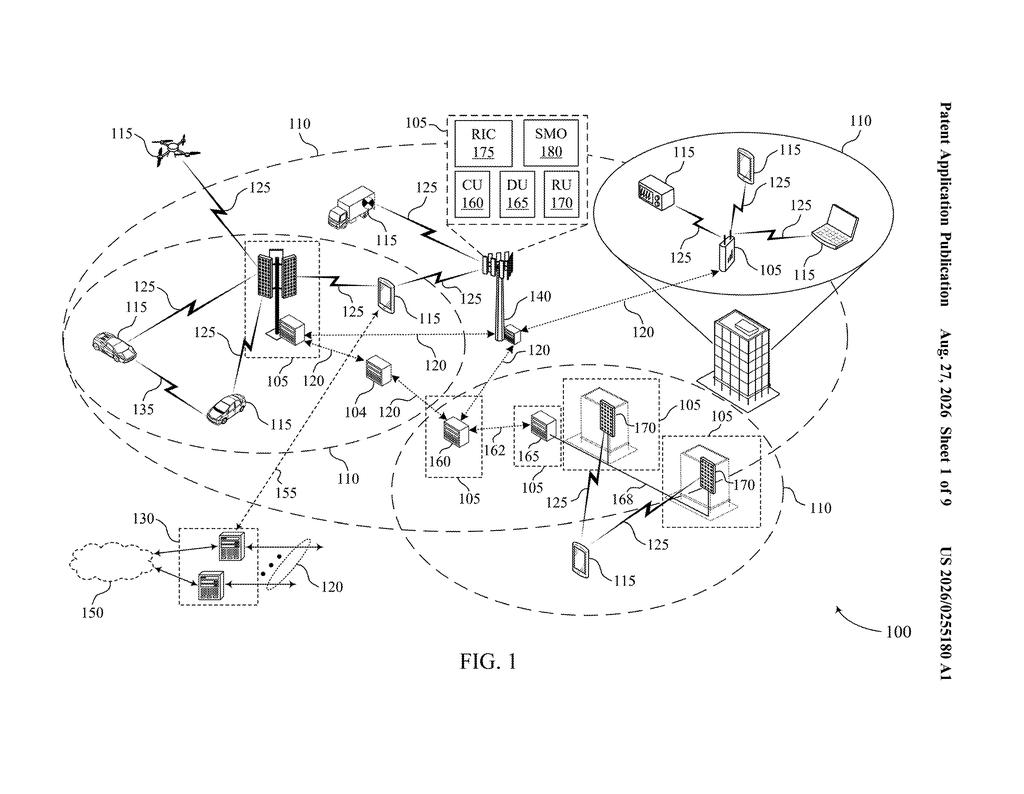
How Qualcomm's time-shifted 3D map system works
Today's 3D maps go stale the moment they're made. A building goes up, a road gets rerouted, a forest grows thicker, and suddenly the map a self-driving car or a wireless network planner is using no longer matches reality. Qualcomm wants to fix that by generating updated virtual copies of real places that reflect how those places change over time.
The idea is to take an existing 3D model of a location captured at one moment, and then apply what the patent calls "time-dependent characteristics" to produce a new version tied to a different point in time. That could mean aging a building, adding seasonal foliage, or modeling a construction project in progress. The result is called a digital twin, a virtual replica of a real location that can be queried and tested without physically revisiting the site.
For you as an end user, this could eventually mean that the navigation app on your phone or the map system in your car stays accurate even when no survey crew has recently driven your neighborhood.
… generate an updated three-dimensional model of the geographic area based at least in part on a modification of the original three-dimensional model in accordance with one or more time-dependent characteristics associated with the geographic area …
Translation: The system updates a 3D map by applying changes that happen over time in that specific location.
How the system modifies an existing 3D model by time
The patent describes an apparatus (essentially a computing system) that takes an original three-dimensional model of a geographic area captured at a specific moment in time and then produces a modified version of that model tied to a different moment in time.
The core steps look like this:
- Obtain data about an existing 3D model of a location, including whatever metadata describes that location's characteristics at the time the model was built.
- Apply time-dependent characteristics (rules or learned patterns about how places change, like seasonal tree cover, construction timelines, or urban development trends) to modify the original model.
- Output a digital twin, a live-queryable virtual copy of the location, based on that updated model and labeled as representing a second, different point in time.
The patent doesn't tie itself to a single industry. The same pipeline that updates a map for a wireless network planner trying to estimate signal coverage next winter would, in principle, also serve an autonomous vehicle system that needs to know what a construction zone will look like six weeks from now. The modification step is where the real complexity lives: the system has to know how a given type of location changes as time passes, which requires either historical data, predictive models, or both.
A digital twin creation entity may obtain data associated with an original three-dimensional model of the geographic area, with the original three-dimensional model being of the geographic area at a first point in time.
Translation: The software starts by loading a standard 3D map that captures a place as it looked at a specific moment.
What this means for self-driving cars and wireless networks
Qualcomm is one of the primary chip suppliers for mobile devices and, increasingly, for the compute modules inside connected cars. Both markets depend heavily on accurate location data. A 3D map that can model itself forward or backward in time is genuinely useful for wireless network planning (predicting how new buildings will block signals) and for autonomous driving (anticipating conditions a vehicle hasn't yet encountered).
The patent is software-forward, meaning there isn't obvious new hardware required to make it work on top of what Qualcomm already builds. That shortens the distance from filing to a real feature, though the hard part is sourcing and training the time-dependent data that tells the system how any given location actually changes. Coverage of this filing and others in the location-intelligence space appears in Big Tech patent news, where the broader push to make digital maps self-updating across chip and software layers is becoming a recurring theme.
Qualcomm's 29th filing we've tracked since July in the self-driving sensing race extends work seen in a 3D graphics surroundings trick and filling gaps in rough 3D maps.
The core idea here is a software layer, not a new device. Qualcomm's existing hardware already processes three-dimensional map data, so the meaningful step this patent adds is adjusting a map forward or backward in time, which is closer to a software update than a ground-up engineering effort.
Getting from this document to a shippable feature hinges on one problem the filing does not solve: where does the information about how a place actually changes over time come from? Without a reliable, large-scale source of that data, any time-shifted map is a guess, and drivers or city planners would have no reason to trust it.
That makes this a real foundation to hold, but not something that ships soon. The shortest route to a product runs through whoever solves the data sourcing problem, and this document leaves that entirely to someone else.
Get our take in your Top Stories
Liked this breakdown? Add Patentlyze as a preferred source on Google, and our plain-English take shows up more often in your Top Stories the next time Qualcomm patent news breaks.
There are more where this came from
We read every patent application Big Tech publishes and send you the ones worth knowing. Plain English, free, every week.
The drawings
9 drawing sheets from US 2026/0255180 A1 · click any drawing to enlarge


Want this weekly breakdown for a company we don't cover? Patentlyze Pro →
Be the first to weigh in