
Waymo Files Patent to Pick Up Riders Where People Actually Walk
Waymo's maps may say a fence blocks the sidewalk, yet its sensors have watched people slip through a gap beside a fire hydrant. A new patent application would let the car meet you at that gap.
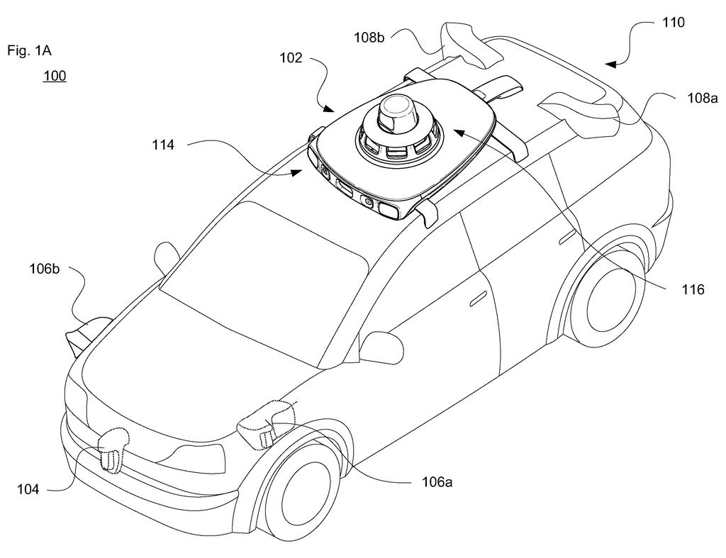
What Waymo's walking-path pickup idea does
Today, a robotaxi mostly decides where to meet you by reading a map, and a map can be wrong about what is really on the sidewalk. A fence might look solid on paper when there is actually a gap where everyone cuts through. Waymo's patent has its cars watch where pedestrians actually walk and use that to choose a better pickup or drop-off spot.
As Waymo's cars drive around, their sensors spot people on foot and trace the routes they take. Over time that builds a heat map: bright where lots of people walk, faint where few do. When you request a ride, the system checks the map's suggestions against those real-world habits.
The result could be a pickup spot that matches how you would naturally walk. It might be shorter, or on the side of the river with the easier crossing, and it may even change with the weather or the time of day.
identifying, by one or more processors of a computing system associated with a fleet of vehicles, at least one pickup or drop-off location based on digital map information corresponding to (i) a pickup or drop-off request and (ii) a heatmap of detected pedestrian walking paths …
Translation: The system finds good pickup spots by combining ride requests with heatmaps of where people walk.
How Waymo turns footsteps into a pickup map
The system starts with the cars' own sensors. Cameras and lidar (laser-based depth sensing) spot objects around a Waymo vehicle, and trained software sorts them into types: someone walking, a jogger, a person with a stroller, a wheelchair user, a cyclist. For each person, the car records a trajectory (a list of positions over time, along with speed and direction). Tracks the software is not confident are people, for example below a 75 or 90 percent likelihood, can be left out, and jittery tracks are smoothed as likely sensor errors.
Those paths from many trips are combined into a heatmap, a map shaded by how often people walk each route. The system then compares it with the ordinary digital map (crosswalks, bike lanes, pullover zones):
- Find candidate spots from the map alone, and a second set from the heatmap alone.
- If the two lists overlap, pick from the overlap.
- If they share nothing, go with the heatmap's spots.
- Or skip the overlap step and simply weight the heatmap's spots more heavily.
Paths can also be tagged with time of day, season, rain, temperature or light, then matched against current conditions, so a snowy evening and a sunny afternoon could produce different spots. Because some neighborhoods have far more data than others, the system can balance how many trajectories it counts per map tile (a small square of the city).
Once a spot is chosen, the vehicle drives itself there, and the rider's phone app can be sent the new location along with walking directions.
A walking path heatmap can be generated based on obtained historical and/or real-time pedestrian-related information, which can be obtained by autonomous vehicles driving in areas of interest.
Translation: Self-driving cars collect live and past walking data to build maps of foot traffic.
Why Waymo's pickup spots could save you a walk
If you have ever been dropped at a spot that was technically fine but awkward, you know the problem. A pickup point that matches where people really walk could mean a shorter trek, a safer crossing, or a stroller or wheelchair route that does not dead-end at a fence. The filing also covers deliveries and owners summoning their own car.
For Waymo, the appeal is that the data is already being collected. Its fleet records every sidewalk it passes, so the more it drives an area, the better its pickup spots could get. Smoother boarding is one of the small details that makes a ride service feel easy, and it also helps the car plan its route and pull over cleanly.
Google's 72nd filing we've tracked since May in our Waymo robotaxi sensing watch adds to a run that includes sensor washing as a health check and tracking hidden pedestrians.
You would notice this one only when it works: the car is waiting right where you were already heading, so you skip the walk around a fence. Anyone who has stood on a corner watching a ride-share circle the block knows how much those few extra steps can matter.
The examples in the filing are down-to-earth: a gap by a fire hydrant, a shortcut across a river, a parking lot with a favorite route to the front door. That makes the idea easy to believe.
The open question is coverage. A neighborhood Waymo cars rarely visit would have thin foot-traffic data, so riders there would likely get the plain map's best guess. The filing shows no results, so the benefit is unmeasured so far.
Get our take in your Top Stories
Liked this breakdown? Add Patentlyze as a preferred source on Google, and our plain-English take shows up more often in your Top Stories the next time Google patent news breaks.
There are more where this came from
We read every patent application Big Tech publishes and send you the ones worth knowing. Plain English, free, every week.
The drawings
23 drawing sheets from US 2026/0326793 A1 · click any drawing to enlarge


Show the other 15 sheets


Want this weekly breakdown for a company we don't cover? Patentlyze Pro →
Be the first to weigh in