Get the newsletter
Mobileye (Intel) · Automotive · Filed Dec 5, 2025 · USPTO published Nov 19, 2026 · This week's release

A New Intel Self-Driving Tech Patent Uses Other Drivers' Paths to Find Where Lanes Split and Merge

Mobileye's patent application teaches a mapping system to spot where a road forks or merges by watching where real drivers peel apart or come together. It then checks the guess against a camera image from that exact spot.
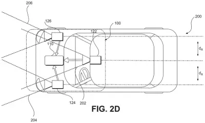
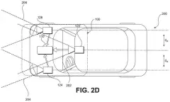
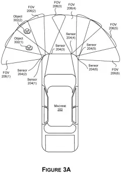
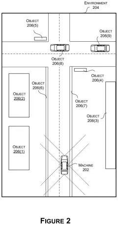
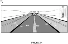
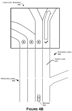
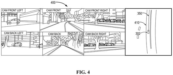
An autonomous car uses multiple forward-facing cameras with overlapping sight lines to track nearby traffic and map the road ahead. Drawing from patent filing US 2026/0366885 A1.
An autonomous car uses multiple forward-facing cameras with overlapping sight lines to track nearby traffic and map the road ahead.All 68 drawings ↓
Publication number
US 2026/0366885 A1(US20260366885A1)
Applicant
Mobileye Vision Technologies Ltd.
Filed · Published
Dec 5, 2025 · Nov 19, 2026
Inventors
Dori SHAPIRA, Daniel BRAUNSTEIN, Yoram GDALYAHU, Kfir VIENTE, Maxim SCHWARTZ, Eli PEKER, David HUBERMAN, Moshe LEVIN, Jonathan BARLEV, Ora ZACKAY, Adi HAYAT, Andras FERENCZ, Dor EAGELBERG
Status when we published
Waiting for an examiner
Document
25 claims
US classification
701/533
Examiner
SMITH, JORDAN T (Art Unit 3666)
Parent application
Continuation of 17/294,984 (filed May 18, 2021)(17294984)

What Mobileye's lane-fork mapping actually does

Ever hovered at a highway fork, unsure which lane carries you where? A human driver reads the paint and the signs. A self-driving system leans on a map, and that map has to know that one lane turns into two.

Mobileye's idea is to build that knowledge from other drivers. Cars that have already driven a stretch of road report the paths they took. When two cars start in the same lane and then drift apart by more than a set distance, the system suspects the road forks. It then pulls a camera image from that spot and looks for lane paint or road structures that back up the suspicion. The image also helps pin down exactly where the fork begins.

Once confirmed, the map stores one path that carries on down one branch and a second path that splits off from it. The same trick runs in reverse for merges, where two lanes funnel into one.

From the filing · CLAIM 33
… determine a divergence between the first actual trajectory and the second actual trajectory based on comparison of a lateral distance between the first actual trajectory and the second actual trajectory to threshold distance; …

Translation: The system finds where cars start drifting apart by measuring the sideways gap between their paths.

How two drivers' paths reveal a lane split

The system runs on a server that collects driving records from many vehicles. Each record includes location points a car logged while driving a road segment, which gives the server each car's actual trajectory (the real path it took). Cameras on those cars can supply images, or the server can pull them from storage.

Then comes the fork-finding routine:

  • Find two trajectories that share a first lane and then end up in two different lanes.
  • Measure the lateral distance (the sideways gap) between them and compare it to a threshold.
  • Pick the image taken where they part, and analyze it for a lane mark or road structure that supports a split.
  • Use that image to refine where the split starts.

Finally the server updates its road navigation model (the map data cars drive by). One target trajectory (the ideal path) covers the lane before the split and continues down one branch. A second target trajectory branches off it into the other lane. Dependent claims also have the server remove anomalies, meaning gaps between paths that are not real splits.

The merge version mirrors this: a convergence between two paths, confirmed by an image, produces two target trajectories that join. The description adds that a host car can receive this model and choose which branch to follow based on what it sees around it.

From the filing · THE ABSTRACT
… update a vehicle road navigation model to include a first target trajectory and a second target trajectory that branches from the first target trajectory after the lane split feature.

Translation: The maps used by self-driving cars are updated to show the exact paths drivers take when a road divides.

Why lane forks and merges matter for car maps

Lane forks and merges are the spots where a driving system most needs to know the plan ahead of time. A map that already says "this lane becomes two" gives the car's software a clear path through them, and your car does not have to figure it out from paint alone.

The approach also saves effort. Mapping crews do not have to survey every interchange. The cars already on the road supply the evidence, and the image check screens out false alarms such as a car that simply wandered across a lane line. The description ties this to Mobileye's sparse map, which stores roads as compact paths instead of heavy imagery, and names its EyeQ chips as possible in-car hardware.

This is the 12th Intel filing we've tracked since September in the self-driving sensing race, following earlier work on building intersection maps and a sharper car radar.

Source: US 2026/0366885 A1 at the USPTO (PDF). Full patent text and figures are in the official publication.

Get our take in your Top Stories

Liked this breakdown? Add Patentlyze as a preferred source on Google, and our plain-English take shows up more often in your Top Stories the next time Intel patent news breaks.

There are more where this came from

We read every patent application Big Tech publishes and send you the ones worth knowing. Plain English, free, every week.

The drawings · 68 sheets

68 drawing sheets from US 2026/0366885 A1 · click any drawing to enlarge

Main computer parts that guide the automated driving car, drawing sheet 1 from US 2026/0366885 A1
Sheet 1 Main computer parts that guide the automated driving car
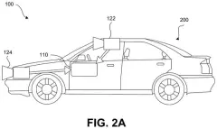
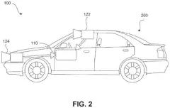
Side view of onboard cameras feeding driving computers, drawing sheet 2 from US 2026/0366885 A1
Sheet 2 Side view of onboard cameras feeding driving computers
Spaced cameras mounted inside the windshield and bumper, drawing sheet 3 from US 2026/0366885 A1
Sheet 3 Spaced cameras mounted inside the windshield and bumper
Twin cameras placed side by side behind the rearview mirror, drawing sheet 4 from US 2026/0366885 A1
Sheet 4 Twin cameras placed side by side behind the rearview mirror
Wide views from three cameras pointing along the road, drawing sheet 5 from US 2026/0366885 A1
Sheet 5 Wide views from three cameras pointing along the road
Clustered windshield cameras sharing one forward view, drawing sheet 6 from US 2026/0366885 A1
Sheet 6 Clustered windshield cameras sharing one forward view
Driving computers controlling throttle, brakes, and steering, drawing sheet 7 from US 2026/0366885 A1
Sheet 7 Driving computers controlling throttle, brakes, and steering
Dashboard screen and mirror sensors for interacting with riders, drawing sheet 8 from US 2026/0366885 A1
Sheet 8 Dashboard screen and mirror sensors for interacting with riders
Show the other 52 sheets
Windshield mount holding three cameras behind the rearview mirror, drawing sheet 9 from US 2026/0366885 A1
Sheet 9 Windshield mount holding three cameras behind the rearview mirror
Front view of the windshield camera bracket and its lenses, drawing sheet 10 from US 2026/0366885 A1
Sheet 10 Front view of the windshield camera bracket and its lenses
An alternative housing grouping three cameras side by side, drawing sheet 11 from US 2026/0366885 A1
Sheet 11 An alternative housing grouping three cameras side by side
Software parts that handle vision, speed, and steering choices, drawing sheet 12 from US 2026/0366885 A1
Sheet 12 Software parts that handle vision, speed, and steering choices
Steering a vehicle using photos from a single camera, drawing sheet 13 from US 2026/0366885 A1
Sheet 13 Steering a vehicle using photos from a single camera
Spotting and tracking other cars and pedestrians across video frames, drawing sheet 14 from US 2026/0366885 A1
Sheet 14 Spotting and tracking other cars and pedestrians across video frames
Reading road markings to build a safe driving path, drawing sheet 15 from US 2026/0366885 A1
Sheet 15 Reading road markings to build a safe driving path
Detecting traffic lights and mapping upcoming intersections, drawing sheet 16 from US 2026/0366885 A1
Sheet 16 Detecting traffic lights and mapping upcoming intersections
Steering a car along a planned route ahead, drawing sheet 17 from US 2026/0366885 A1
Sheet 17 Steering a car along a planned route ahead
Detecting whether a car in front is changing lanes, drawing sheet 18 from US 2026/0366885 A1
Sheet 18 Detecting whether a car in front is changing lanes
Using two camera views to steer the car, drawing sheet 19 from US 2026/0366885 A1
Sheet 19 Using two camera views to steer the car
Combining three camera feeds to make driving choices, drawing sheet 20 from US 2026/0366885 A1
Sheet 20 Combining three camera feeds to make driving choices
Storing compact map data in car memory, drawing sheet 21 from US 2026/0366885 A1
Sheet 21 Storing compact map data in car memory
Modeling road edges and driving lines as math curves, drawing sheet 22 from US 2026/0366885 A1
Sheet 22 Modeling road edges and driving lines as math curves
Road signs and lights used as map landmarks, drawing sheet 23 from US 2026/0366885 A1
Sheet 23 Road signs and lights used as map landmarks
Following a smooth path across road lanes, drawing sheet 24 from US 2026/0366885 A1
Sheet 24 Following a smooth path across road lanes
Multi-lane roads and junctions marked with roadside landmarks, drawing sheet 25 from US 2026/0366885 A1
Sheet 25 Multi-lane roads and junctions marked with roadside landmarks
Calculated travel lines through intersections and lane splits, drawing sheet 26 from US 2026/0366885 A1
Sheet 26 Calculated travel lines through intersections and lane splits
Road height changes captured along a driven route, drawing sheet 27 from US 2026/0366885 A1
Sheet 27 Road height changes captured along a driven route
Cars sending real-time driving paths to a central server, drawing sheet 28 from US 2026/0366885 A1
Sheet 28 Cars sending real-time driving paths to a central server
Three-dimensional curves mapped from recorded vehicle positions, drawing sheet 29 from US 2026/0366885 A1
Sheet 29 Three-dimensional curves mapped from recorded vehicle positions
Turning trips from many drivers into a shared road map, drawing sheet 30 from US 2026/0366885 A1
Sheet 30 Turning trips from many drivers into a shared road map
Matching landmarks seen on separate trips to line up paths, drawing sheet 31 from US 2026/0366885 A1
Sheet 31 Matching landmarks seen on separate trips to line up paths
Grouping multiple sightings of the same street sign, drawing sheet 32 from US 2026/0366885 A1
Sheet 32 Grouping multiple sightings of the same street sign
How a car sends road data to the cloud, drawing sheet 33 from US 2026/0366885 A1
Sheet 33 How a car sends road data to the cloud
Combining drives from many cars into one map, drawing sheet 34 from US 2026/0366885 A1
Sheet 34 Combining drives from many cars into one map
Steps for turning crowdsourced car images into a road map, drawing sheet 35 from US 2026/0366885 A1
Sheet 35 Steps for turning crowdsourced car images into a road map
Hardware parts inside the server that builds driving maps, drawing sheet 36 from US 2026/0366885 A1
Sheet 36 Hardware parts inside the server that builds driving maps
Programs stored to create and send out driving models, drawing sheet 37 from US 2026/0366885 A1
Sheet 37 Programs stored to create and send out driving models
Sorting messy driver paths into organized traffic directions, drawing sheet 38 from US 2026/0366885 A1
Sheet 38 Sorting messy driver paths into organized traffic directions
Inside sensors connecting a car to map servers, drawing sheet 39 from US 2026/0366885 A1
Sheet 39 Inside sensors connecting a car to map servers
Creating and sharing autonomous driving maps using crowd data, drawing sheet 40 from US 2026/0366885 A1
Sheet 40 Creating and sharing autonomous driving maps using crowd data
How the car steers using cameras and simple maps, drawing sheet 41 from US 2026/0366885 A1
Sheet 41 How the car steers using cameras and simple maps
Navigating a car by matching camera feeds with map data, drawing sheet 42 from US 2026/0366885 A1
Sheet 42 Navigating a car by matching camera feeds with map data
Cloud servers that align past drives along a road, drawing sheet 43 from US 2026/0366885 A1
Sheet 43 Cloud servers that align past drives along a road
Matching landmarks from multiple drives to a target path, drawing sheet 44 from US 2026/0366885 A1
Sheet 44 Matching landmarks from multiple drives to a target path
Tracking roadside landmarks across drives after a lane change, drawing sheet 45 from US 2026/0366885 A1
Sheet 45 Tracking roadside landmarks across drives after a lane change
Tracing road boundaries by combining landmark sightings across trips, drawing sheet 46 from US 2026/0366885 A1
Sheet 46 Tracing road boundaries by combining landmark sightings across trips
Building accurate road lines by matching patches of trip data, drawing sheet 47 from US 2026/0366885 A1
Sheet 47 Building accurate road lines by matching patches of trip data
Car memory software for logging and uploading road feature positions, drawing sheet 48 from US 2026/0366885 A1
Sheet 48 Car memory software for logging and uploading road feature positions
Sending spotted road landmarks to a central mapping server, drawing sheet 49 from US 2026/0366885 A1
Sheet 49 Sending spotted road landmarks to a central mapping server
Software parts that calculate a car's distance and drift, drawing sheet 50 from US 2026/0366885 A1
Sheet 50 Software parts that calculate a car's distance and drift
Driving down an unmarked lane using remembered map boundaries, drawing sheet 51 from US 2026/0366885 A1
Sheet 51 Driving down an unmarked lane using remembered map boundaries
Passing another vehicle while following virtual lane edges, drawing sheet 52 from US 2026/0366885 A1
Sheet 52 Passing another vehicle while following virtual lane edges
Comparing overhead road signs against saved map positions, drawing sheet 53 from US 2026/0366885 A1
Sheet 53 Comparing overhead road signs against saved map positions
Correcting a car's driving path along unmarked pavement, drawing sheet 54 from US 2026/0366885 A1
Sheet 54 Correcting a car's driving path along unmarked pavement
Shifting back toward lane center while passing traffic, drawing sheet 55 from US 2026/0366885 A1
Sheet 55 Shifting back toward lane center while passing traffic
Realignment using an overhead highway sign as a reference marker, drawing sheet 56 from US 2026/0366885 A1
Sheet 56 Realignment using an overhead highway sign as a reference marker
Correcting a car's steering based on nearby lane markings, drawing sheet 57 from US 2026/0366885 A1
Sheet 57 Correcting a car's steering based on nearby lane markings
Cars navigating a highway as a new lane opens, drawing sheet 58 from US 2026/0366885 A1
Sheet 58 Cars navigating a highway as a new lane opens
Grouping recorded paths from multiple drives along an opening lane, drawing sheet 59 from US 2026/0366885 A1
Sheet 59 Grouping recorded paths from multiple drives along an opening lane
Turning grouped driver paths into a mapped lane branch line, drawing sheet 60 from US 2026/0366885 A1
Sheet 60 Turning grouped driver paths into a mapped lane branch line

Sheets 61 to 68 are in the full USPTO filing.

Patent filing page

Watchlists this filing belongs to

All watchlists →
Reader comments

No comments yet

Start the discussion

Real name or a handle, either is fine. Comments are read by a person before they appear, so allow a little time. Keep it about the filing.