
X (Google)
X (Google) · Energy · Filed Jul 23, 2026 · USPTO published Nov 19, 2026 · This week's release
Google Patents a Method for Locating Power Poles Using Multi-Angle Photos
Utilities often don't know exactly how many power poles they own or where each one stands. A new patent application from Alphabet's X lab uses photos from the sky and the street to fix that.
- Publication number
- US 2026/0369053 A1(US20260369053A1)
- Applicant
- X Development LLC
- Filed · Published
- Jul 23, 2026 · Nov 19, 2026
- Inventors
- Xin-Jing Wang, Anthony Ha, Sze Mei Cat Wong, Reuben Nahouraii, Arthur Robert Pope, Om Prakash Ravi
- Status when we published
- Waiting for an examiner
- Document
- 20 claims
- US classification
- 382/159
- Parent application
- Continuation of 18/226,716 (filed Jul 26, 2023)(18226716)
What X's power-pole photo checker actually does
Every time a storm knocks out power, a utility crew leans on a map of the grid. If that map is wrong, a pole might be listed that was moved years ago, or a real one might be missing entirely. The filing says utilities often lack up-to-date data on how many poles they have and where they are.
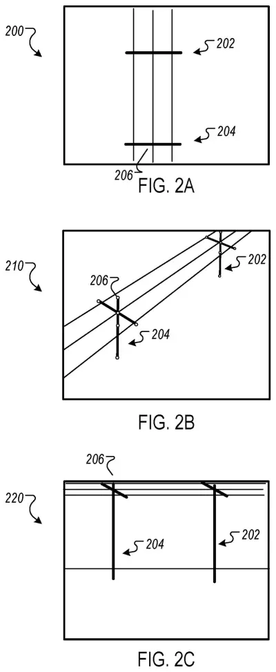
This application from X Development, Alphabet's experimental lab, describes a way to check the map against pictures. The system picks a pole from the utility's digital grid model, pulls photos of that spot taken from above, from an angle, and from the street, and asks an AI model whether the same pole shows up in all of them. If it doesn't, the pole is flagged as moved or gone, and the map gets corrected.
… determining whether the electrical grid asset exists at the geographic location by processing the set of images using a machine learning model to generate an output, wherein the machine learning model has been trained to correlate electrical grid assets in a combination of images representing common geographic locations taken from different perspectives …
Translation: An AI checks photos taken from multiple angles to see if a utility pole is actually there.
How the model matches one pole across three views
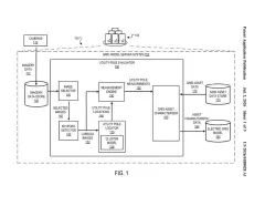
The claimed method is a verification loop for a computer model of the power grid (a digital map listing each pole, tower, or part on a pole, with its location). It works in four steps:
- Pick an asset from the grid model, along with its recorded location.
- Gather a set of images of that location, each taken from a different perspective.
- Run the images through a machine learning model (software trained on many labeled examples) that decides whether the asset is really there.
- Update the grid model based on the answer, for example by removing a pole that isn't found.
The model is trained to correlate the same asset across overhead, oblique (angled, from the air), and ground-level images. Each type has a weak spot: overhead shots have reliable coordinates but low detail, while street-level shots are sharp but often lack location data. The model matches visual clues such as pole markings, attached equipment, and nearby trees.
The description also covers a search method. After one pole is found, the system checks nearby spots and follows the line of poles, and when the trail ends it looks around for the turn. It can also check whether a grid sensor is really attached to a pole, and it can be trained with photos from different seasons and with some views left out.
In response to an ML output that indicates a positive identification of the same electrical grid asset being depicted in a particular set of images of a particular location, the method further includes: selecting a number of sublocations within the region, and executing the detection process for each sublocation.
Translation: When the system spots a pole, it scans smaller surrounding areas to narrow down the exact spot.
Why utilities could use a self-correcting grid map
If your lights go out, the speed of the repair depends partly on whether the utility's records match what is standing on the street. The filing says outdated pole data makes it harder to model, maintain, and respond to problems on the grid. A map that checks itself against fresh photos could cut down on crews driving out to check what the records say.
The idea also covers more than poles. The filing says the same approach could find power towers, transformers, and switches, and could be extended with sensor data. For utilities that already collect aerial and vehicle imagery, this turns existing photo archives into a way to audit the grid. The filing gives no accuracy figures, so how well it works is still an open question.
This is the 1089th Google filing we've tracked since May in our Google coverage, a corpus that includes work like spreading out fingerprint checks and AI splitting audio types.
Source: US 2026/0369053 A1 at the USPTO (PDF). Full patent text and figures are in the official publication.
Get our take in your Top Stories
Liked this breakdown? Add Patentlyze as a preferred source on Google, and our plain-English take shows up more often in your Top Stories the next time Google patent news breaks.
Add Patentlyze on Google
One click.
There are more where this came from
We read every patent application Big Tech publishes and send you the ones worth knowing. Plain English, free, every week.
The drawings · 8 sheets
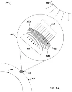
8 drawing sheets from US 2026/0369053 A1 · click any drawing to enlarge


More from Google
All 1,127 Google patents →
More in Energy
All 140 Energy patents →
Samsung
Samsung Patents a Leg-Assist Wearable That Won't Power Up Until It's Strapped On Right
Microsoft
Microsoft Patents a Laptop Charger That Reels in Its Own Cable
Tesla
Tesla Files Patent for a Battery Fluid Recipe That Cuts Gas Buildup
Amazon
No comments yet